Best Hikes on The Amalfi Coast
This post will introduce you to the best hikes along the Amalfi Coast.
You will find everything from super popular hikes like Sentieri degli Dei (Path of Gods) to hidden gems and off-the-beaten-path trails.
At the end of the post are handy tips on signs and safety.
And information on the local flora, like wild orchids.
Step into the Adventure with us! Join our 4-day organized hiking tour of the Amalfi Coast, including the Lemon Path, Path of the Gods, Ferriere Valley, and the Avvocata Sanctuary. Stay in beautiful Maiori. Pre-register now—limited spots!


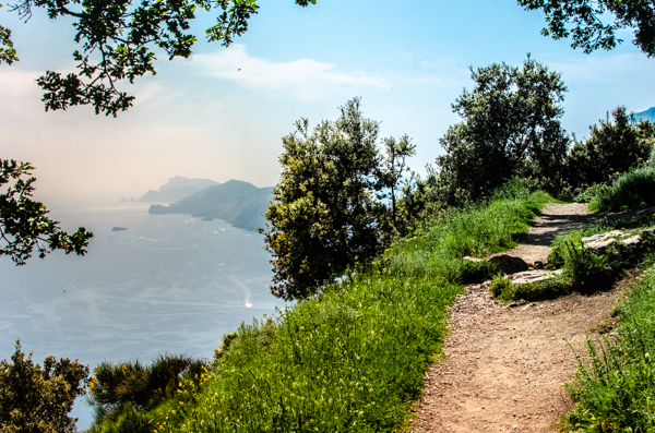
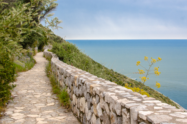
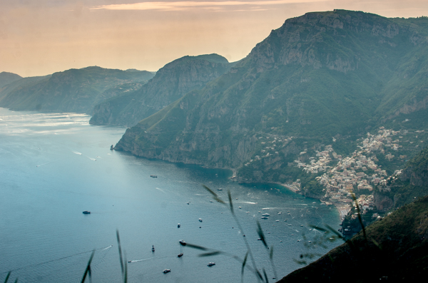
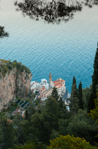
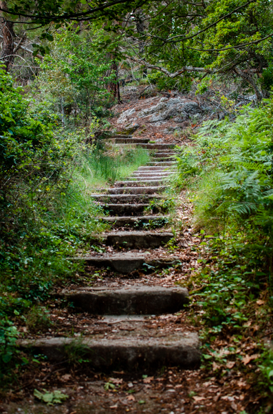
Path of the Gods: The best hike for views on the Amalfi Coast
The Path of the Gods is the most famous hike on the Amalfi Coast, because of its stunning views.
It’s a long hike, so you should be in fairly good shape to complete it. Start from Bomerano, as the alternative route from Praiano requires you to ascend around 300 meters right at the beginning, which is quite steep.
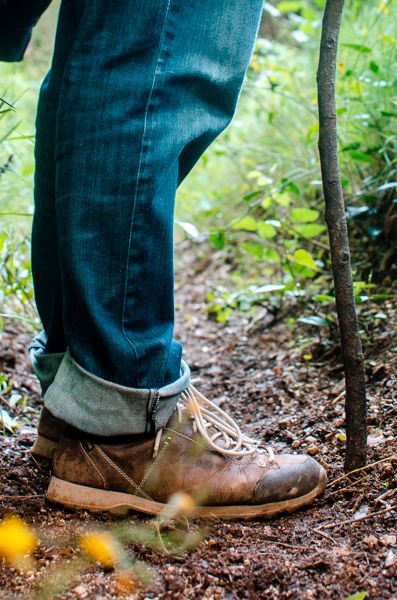
The trail is moderately difficult and often goes on steep mountainsides. If you’re used to hiking, you should be fine. However, if you have no prior hiking experience, you may find it challenging. In this case, it’s better to hire a guide. Good footwear is a must due to the rocky terrain.
Being the most popular trail on the Amalfi Coast, it’s also one of the best signed.
The Path is connecting Bomerano to Nocelle. Nocelle is a small village just above Positano. Once you reach Nocelle, you can take the local bus down to Positano. Or also possible to walk down instead.
Walking the Path of Gods is definitely one of the highlights of your holiday. The hike is at a high elevation. And from the trail, you see the end of the Sorrento Peninsula and Capri. Best to hike From Bomerano to Positano, as the spectacular view is in front of you in this case.
How to reach the trailhead? The hike starts from Bomerano, Agerola. You can reach Agerola by local SITA bus, or some ferries arriving in Amalfi have shuttle buses to take you at the beginning of the trail.
How long it takes? The hike is around 7 km long. To complete it takes between 3-4 hours.
Find out more about the Path of Gods in my dedicated blog post.
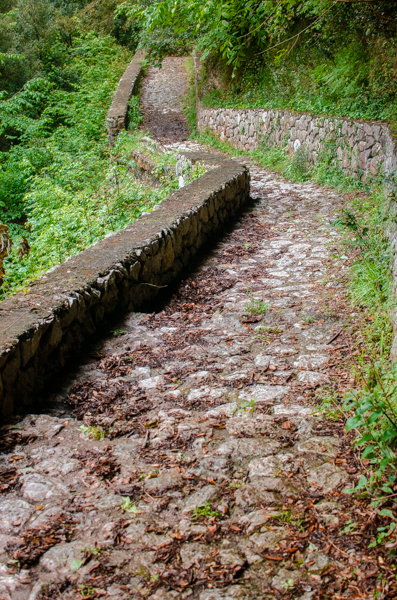
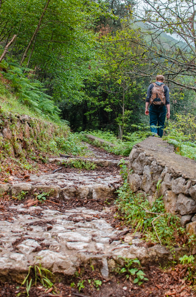
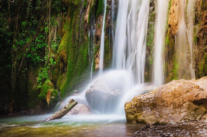
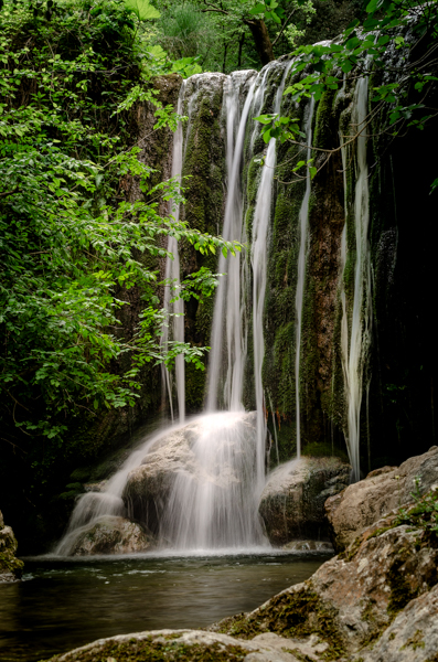
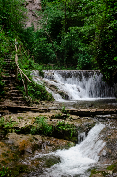
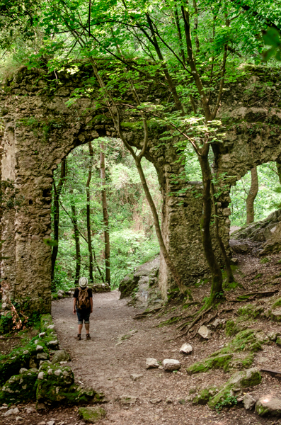
Valle delle Ferriere / Ferriere Valley: The best easy hike with a lot of waterfalls
Pleasant hike in a shady forest. Just behind the town of Amalfi. This is a very popular trail. Along the path, you can see the ruins of Cartiere (Paper Mills). And admire the remaining monumental arches from the Ferriere (Iron Works). Hiking this route, you will see many waterfalls. At the end of the trail, you’ll find the Riserva Naturale Orientativa. This is a small but interesting area. If you want to visit, the ticket costs 5 euros. The highest waterfall in the Valley is inside this area.
You can start from Amalfi and walk back along the same route to Amalfi. Alternatively, you can begin from Pontone and finish in Amalfi. Which is a better option if you have a car. Since there is parking available at the trailhead in Pontone. Note that to return on foot from Amalfi to Pontone, you’ll have to climb some very steep steps.
This hike stands out as one of the best on the Amalfi Coast for multiple reasons. First, it’s an easy trail suitable for all fitness levels. It’s easily manageable with kids. Being just behind Amalfi, it’s simple to reach the starting point.
The forest here is different from elsewhere on the Amalfi Coast. Lots of lush vegetation, with many ferns. The Valley has a subtropical microclimate. Making it very green and rich in water.
You will find all the information you need on Valle delle Ferriere in my blog post dedicated to this hike.
Trailhead: Amalfi, near the Paper Museum. Or the parking lot in Pontone.
The trail is 3 km long.
To complete it and get back to Amalfi: around 2-3 hours.
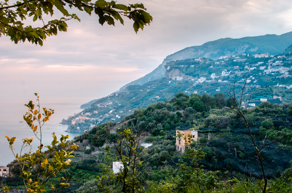
Avvocata Sanctuary: Best Entry to Amalfi Coast is trekking through the mountains on foot.
Mount Avvocata is an important pilgrimage route for many of the surrounding villages. You can reach the church via different paths.
We took the route from Dragonea (Vietri) once. And on a different occasion, we also hiked up from Maiori.
Many people start this hike from the upper part of Cava de’ Tirreni. Which is one of the most popular routes. Because even if this is the longer way, also the least challenging one. Here, you’ll have ample time to cover the elevation. In Corpo Cava near the Abbey (worth a visit), you will find the starting point. Perfect hike if you want to arrive on the Amalfi Coast on foot. The full-day hike will take you to the Sanctuary then you can finish it at Maiori.
The Avvocata Sanctuary itself is closest to Maiori. And you can see it perched on the mountain, just above the town. Follow the well-signed indications to find the trail from Maiori. It’s the shortest but also the steepest way to reach the church. So be prepared for a 600-meter elevation gain.
Starting point at Maiori:
Starting Point in Cava de Tirreni: If you’re coming from Cava, take bus number 61 from the station up to the Abbey.
This is a full-day hike.
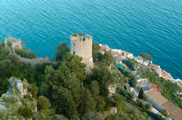
Torre dello Ziro
Torre dello Ziro is one of the best shorter hikes on the Amalfi Coast. This is my favorite half-day hike. It’s mostly of moderate difficulty. You can start from Pontone, which you can reach by bus. Or from Atrani or Amalfi if you have more time and aren’t afraid of some elevation gain and steps.
The hike itself takes you through a pine tree-covered path. Along the way, you can explore different panoramic viewpoints. This hike has splendid views of Amalfi and Atrani.
The tower itself comes with a lot of legends.
Trailhead: From Pontone
From Amalfi: Take the steps upwards to Pontone. The stairs are spectacular, under a rock wall. You will need around 40 minutes to cover this section, and it’s steep. Once in Pontone, look for the ceramic signs indicating the Tower.
From Atrani: Walk up to the Dragone Valley. Cross the little bridge above the river. And take the steps going upwards. Once you reach Pontone, take the trail on your left side. Here, the direction to Torre dell Ziro is well signed.
From Pontone to the tower and Back: 1,5 hours
From Atrani and Amalfi and back 3 hours
Agave in Bloom Trail in Furore
This trail runs from Furore to Marina di Praia. And it’s a small path along the hillside. It offers a moderate level of difficulty but isn’t very well signposted. The trail starts at Località Furore, near the Path of Love.
I found this to be an excellent training route if you are planning to do the Sentieri degli Dei. It offers a shorter and easier version with some similarities.
As the trail’s name suggests, you will encounter many agave plants along the way. There isn’t much shade, so plan accordingly, especially during hot summer days.
I really enjoyed this hike. It was surprisingly scenic and not very difficult. If you start from Furore, the path is mostly descending. A lot of stunning views along the road. I will be hiking on this route again. It’s also outside of the typical tourist paths, so it isn’t a busy hike.
We missed the sign indicating the descent to Marina di Praia, so we ended up taking a slightly longer route.
Trailhead: Furore locality Path of “Innamorati”.
In Praiano: Near the bridge, above marina di Praia.
Time to complete from Furore to Praia Marina: 2 hours
Ferriere Valley Upper Trail
This trail is best suited for experienced hikers, especially if you plan to complete the whole route between Agerola and Pogerola. However, you can do the first section of the hike until you reach the point of Fico Noce. Which is suitable for hikers of all fitness levels.
Fico Noce Point has some amazing waterfalls worth exploring. From there, the descent into the Riserva is optional, but it requires some hiking techniques. Afterward, you can continue on the trail and reach the village of Pogerola.
For the full hike, experience and preparation are essential. Be ready for rain by carrying a raincoat, wear sturdy shoes, and bring a map, as some sections of the trail can be easy to miss.
Montepertuso il Buco above Positano
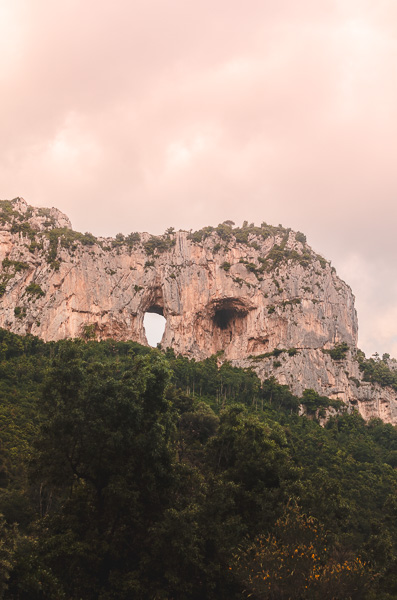
A popular hike above Positano, Montepertuso. It’s not very difficult, but it mainly consists of steps. Starting from the center of Montepertuso, ascend the steep stairs and continue along the trail. You can descend on the other side to make it a loop.
The highlight of this hike is the enormous and intimidating hole in the mountain. According to legend, it was created by the Virgin Mary.
This hike is the best choice if you’re staying in Positano. And looking for a shorter trail with some stunning views. You can reach the starting point by taking the local bus from Positano to Montepertuso.
Trailhead: Montepertusso central square
Time to complete and back to Montepertuso: 1,5 hour
More info on this hike and what to do in Positano here.
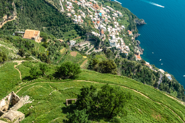
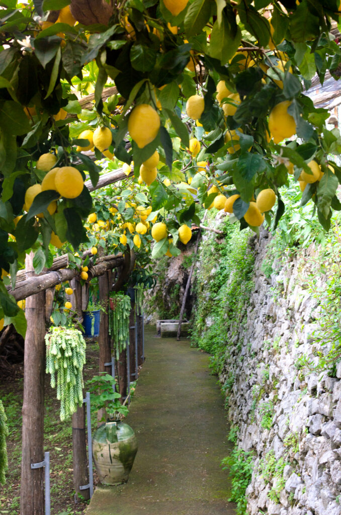
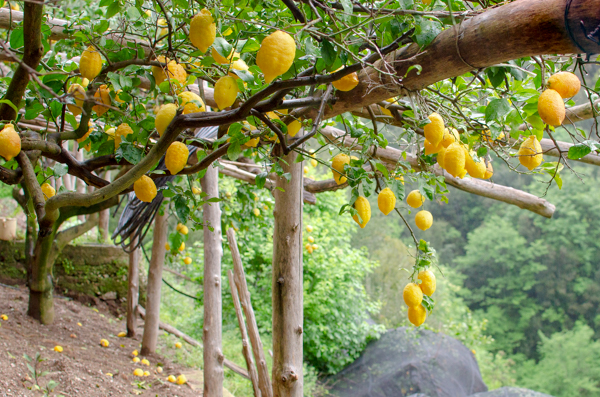
Path of Lemons
The Path of Lemons is the best walk suitable for everyone. It’s not quite a hike, but it does involve some steps. It’s the ideal choice for families with kids or for the elderly.
This picturesque path is located between Minori and Maiori, with the starting point in Minori. You can also start from Maiori if you prefer.
The walk typically takes around an hour and a half to complete.
Locals sell lemonades along the pathway made with fresh lemons.
Book a Guided tour with our affiliate partner Manawa.
Trekking on the Path of the Lemons from Ravello to Maiori, Amalfi Coast.
Check out my description with a lot of pictures on the Lemon Trail.
Best Hikes for Kids: Path of Lemons and Valle delle Ferriere
Don’t miss the Paper Museum at the beginning of the Valle delle Ferriere Trail.
Best Hikes Suitable for All Fitness Levels: Path of Lemons and Valle delle Ferriere
Best Hikes on the Amalfi Coast: Path of Gods, Valle delle Ferriere
For Seasoned Hikers: Upper Trail of Ferriere Valley, Avvocata Sanctuary
Best Off the Beaten Path Hike: Agave in Bloom
There is also a zipline nearby if you are feeling adventurous.
Best Short Hikes: Monte Pertuso Il Buco from Positano, or Torre del Ziro from Amalfi.
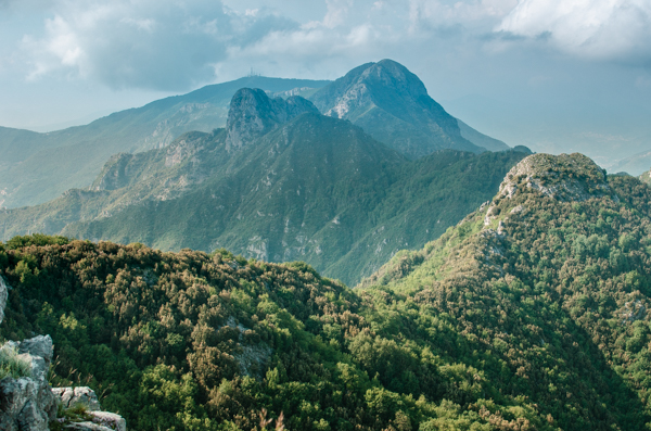
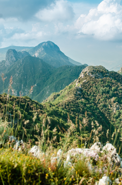
Monti Lattari / Lattari Mountains
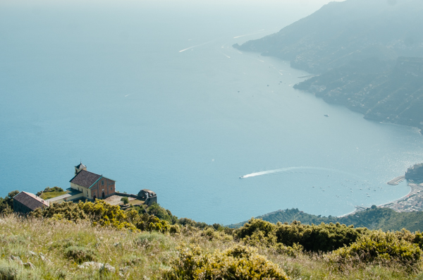
The mountain range that dominates the landscape of the Amalfi Coast and stretches on the Sorrento Peninsula is called Monti Lattari.
The longest scenic route is the Alta via dei Monti Lattari. That one takes several days to complete. And it’s a 70 km (43 miles) hike along the peninsula.
It starts from Cava de’ Tirrene and arrives at Punta Campanella, the very edge of the peninsula .
Monte Faito (1400 m) is one of the highest peaks on the Sorrento Peninsula. The highest peak in the mountain range is Monte San Michele with 1,444 meters (4734 ft.) above sea level altitude.
It’s mostly known by its nickname Monte Molare. The name comes from its looks that resemble the shape of a molar teeth.

What to Bring and How to Prepare for the Hikes
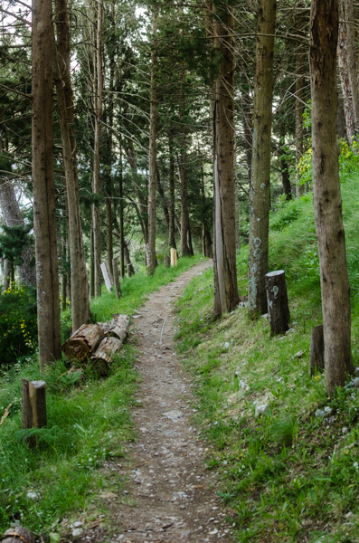
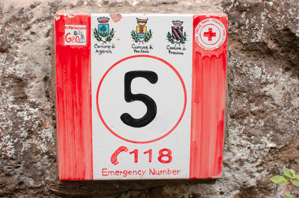
Trails and Signs
Most trails are numbered by the local alpine community called CAI-Monti Lattari.
You can see numerous hikes on their page.
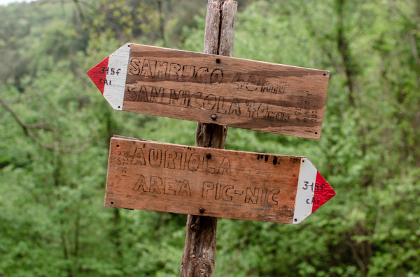
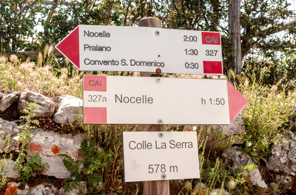
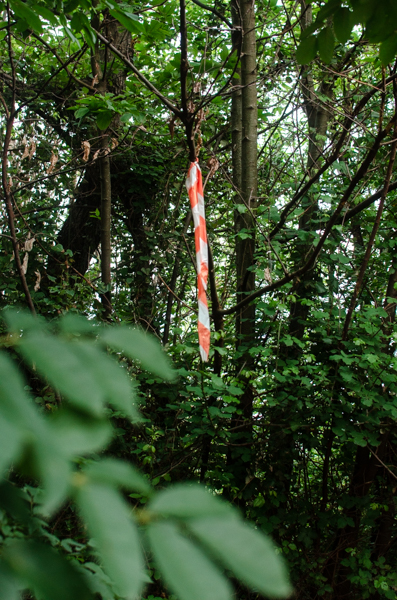
The trails are usually indicated with red and white stripes. In some less touristy paths are little red dots sprayed on rocks or red and white ribbons knotted on trees. The Sentieri Degli Dei and Valle Delle Ferriere are well-marked, as they are the most popular hikes.
Even on sunny days, occasional showers can occur. So bring a rain jacket with you. As always, good hiking shoes are a must.
Download an offline map. I use the application “Maps.me”. Since internet and cell coverage can be spotty in the mountains. You can also buy maps of the area at bookshops in Salerno or Sorrento. Look for those made by CAI (Club Alpino Italiano).
Carry food and plenty of water with you. Although many trails have water sources along the way, it’s not guaranteed.
Best Time to Hike
Hiking is an amazing activity on the Amalfi Coast all year round.
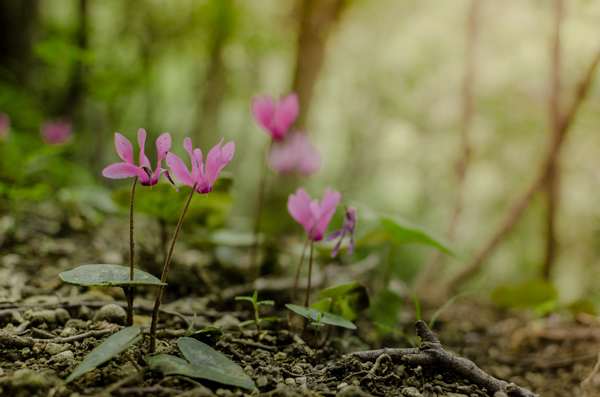
My favorite time is during sunny winter days. When visibility is crisp with the deep blue sea in the distance. But every season is different in the mountains, and the scenery changes quickly. In January, you will see blooming crocuses, and in May, the forest has carpets of cyclamens.
November and late February, with early May, are the wettest months. So they are less suitable for trekking. Avoid hiking after several heavy rainy days, as the area is prone to landslides. And trails can become very muddy.
August can be hot. And many paths do not have too much shade. In summer, try to choose trails in the forest like the Ferriere Valley, where you can also cool down with a swim in the rivers and waterfalls.
Why You Should Go
Apart from getting the best views, there are other reasons too. Many trails pass through the countryside and less touristy areas of the Amalfi Coast. Hiking on the outskirts of villages offers sneak peeks into the life of the locals. With the good weather, people tend to be out in their gardens and working. We often encountered friendly and welcoming farmers. Some even showed us around in their lemon grooves. And gifted us with lemons straight from the tree.
You will see what made this piece of the world part of UNESCO World Heritage: The agricultural terracements made by ancient ancestors. Maintained and cared for throughout many generations. Lemons, olives, and even grapes are cultivated on the Amalfi Coast. People were able to transform this challenging land into thriving orchards. Today, the Amalfi Coast farmers are producing world-class fruits and wines. However, harvesting from the higher and more remote terraces is hard work. Abandonment of the ancient terraces is a problem of our generation.
Discovering the Amalfi Coast is best on foot and using the ancient pathways. And Hiking is the simple best way to get to know the region and its people.
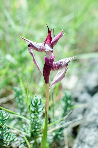
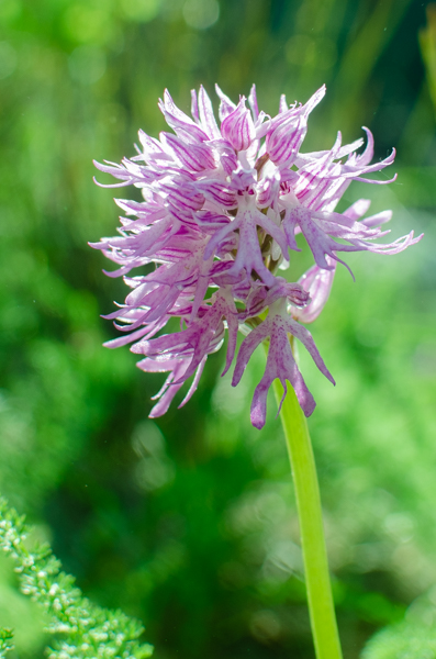
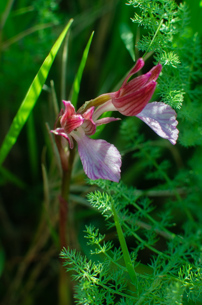
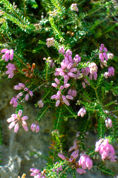
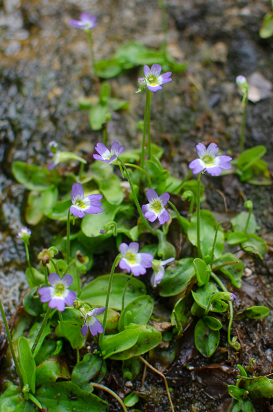
The Flora
This area is home to several wild orchid species. They bloom at different times of the year. So you can see some almost year-round. For example, the Bee orchids, Orchis Italica, and several species of Butterfly orchids are among the many present on the Amalfi Coast.
Rare plants, the so-called “living fossils” are also present.
One example is the Woodwardia Radicans Fern, which you can see in the Feriere Valley. The carnivorous plant Pinguicula Hirtiflora plant also has some clusters hidden in the area.
Safety on the Trail:
Bring enough water to stay hydrated during your hike.
Go with appropriate and comfortable footwear for the trail.
Beware of wild boars:
The wild boar population is quite high in some areas. And they are known to raid gardens for food. Locals often warned us when we hiked to be careful on the paths. Wild boars tend to be most active during the evening at dusk, so it’s best to avoid secluded trails around that time.
If you find yourself in the forest during dusk: make noise as you walk. This helps alert them to your presence. Wild boars are typically more afraid of humans, so they usually hide away. If I’m alone, I often sing, or if I’m with a hiking companion, we chat in a loud voice.
Exercise extra caution during May, June, and July, as wild boars are more likely to be aggressive when defending their offspring during this period.
Avoid hiking after heavy rain:
Don’t plan hikes right after heavy rains, as hillsides are slippery. Heavy showers can lead to landslides and flash floods.
Watch out for vipers in summer: In some areas, especially on sunny days, vipers can sunbathe on stones. Wear closed footwear, and watch your steps. And make noise as you walk to scare them away.
Download an offline map, or even better, pack a good old paper map because, you know, paper maps never run out of battery power.
Happy hiking!